Resources - Watershed & Wetlands
Filter By:
All Resources | Natural Heritage | Community Heritage | Shoreline & Property Protection | Tax Relief | Tours & Guides | Watershed & Wetlands
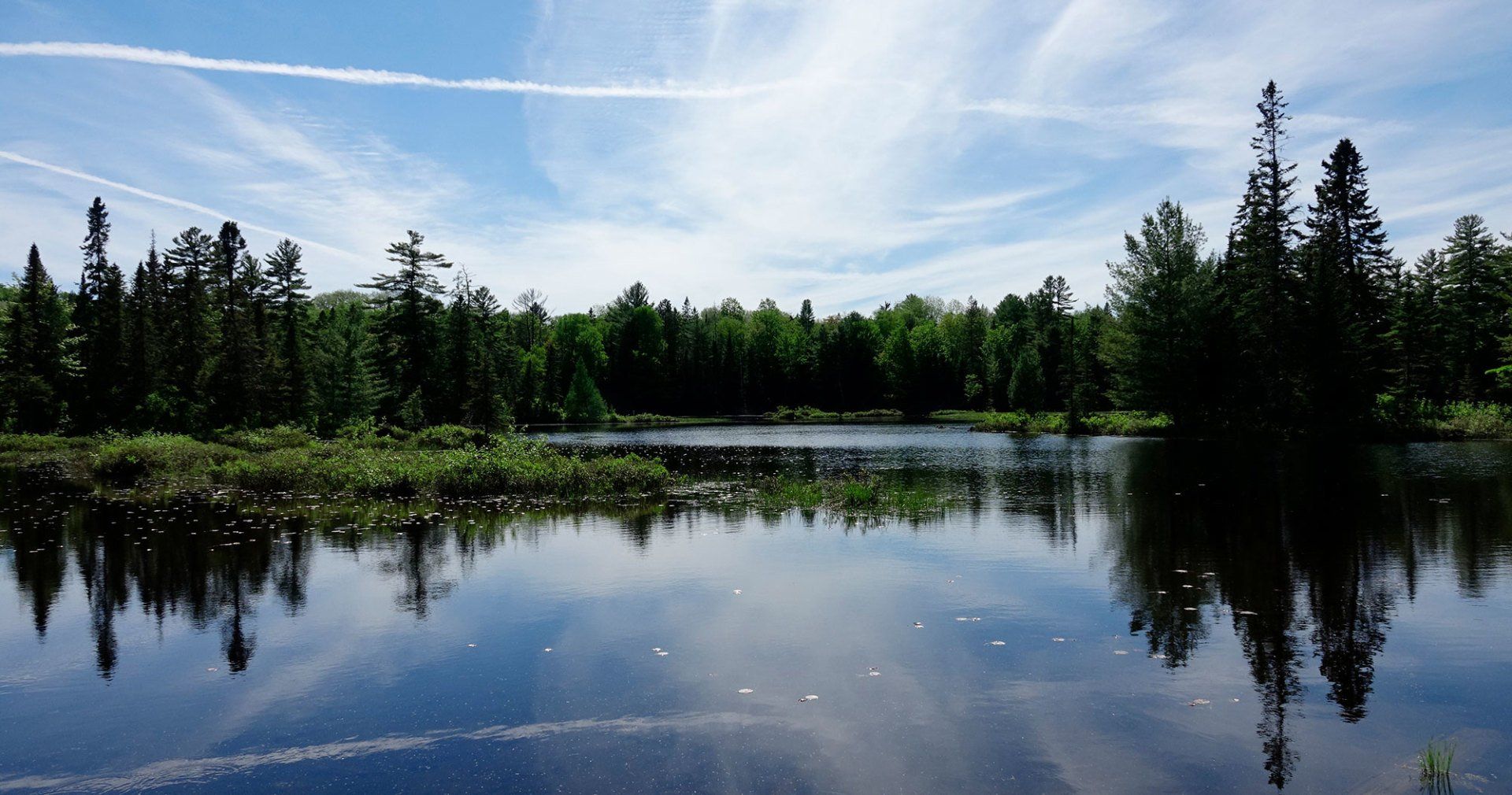
The Muskoka River watershed originates on the western slopes of Algonquin Park, descending 300 metres in elevation over a distance of 210 kilometres before flowing into Georgian Bay via the Musquash/Gibson and Moon rivers. The watershed is approximately 5,100 square kilometres (approximately the size of Prince Edward Island) and includes more than 2,000 lakes of various sizes with a total surface area of approximately 78,000 hectares. The watershed receives more than 1,000 millimetres of precipitation each year and is one of the wettest locations in the province of Ontario. Annual precipitation includes more than 300 centimeters of snowfall typically representing 20% to 25% of the annual wet precipitation amount. The lakes, rivers and wetlands within the Muskoka River watershed support a diversity of natural ecosystems, tourism and recreation activities, and businesses including hydroelectric generation. The Muskoka River is comprised of three subwatersheds: the north and south branches of the Muskoka River, and the Lower Muskoka subwatershed comprised of the Musquash/Gibson River and Moon River. There are a total of 41 water control structures located throughout the river including 11 waterpower facilities and 30 dams. The Ministry of Natural Resources (MNR) owns and operates 29 of these dams. There are 13 water control structures on the south branch of the Muskoka River and its tributaries including the Baysville Dam which regulates Lake of Bays water levels and downstream flows within the South Muskoka River. The portion of the south branch subwatershed upstream of the Baysville Dam is 1,481 square kilometres. Most of the inflow to Lake of Bays is from the Oxtongue River and Hollow River. Flows within the Oxtongue River are influenced or controlled primarily by the Tea Lake Dam within Algonquin Park which regulates water levels on Tea Lake and Smoke Lake. Flows within the Hollow River are controlled by the Kawagama Lake Dam which regulates Kawagama Lake water levels. In 2002, the MNR produced the Water Management Planning Guidelines for Waterpower to provide a formal planning framework for the operation of waterpower facilities and dams for river systems within the province. A water management plan is intended to provide for the management of water levels and flows on a “watershed” basis to equitably address or balance environmental, social and economic interests within the lakes and river reaches. The Muskoka River Water Management Plan (MRWMP) came into affect in June, 2006. This plan provides for the management of water levels and flows as they are affected or controlled by the operation of each water control structure. Currently there are four waterpower companies and the MNR Parry Sound District signatory to the MRWMP. The MRWMP report and additional information and resources can be viewed on the Muskoka WaterWeb at: www.muskokawaterweb.ca/water-101/water-quantity/mrwmp . The MRWMP includes the lake Operation Plan for each water control structure, enforceable provisions for the management of flows and levels, compliance monitoring to ensure that waterpower facilities are meeting requirements, and effectiveness monitoring to determine whether the ongoing implementation of the plan results in attaining the ecological, social and economic objectives. A number of objectives were identified during the planning and consultation phase of the MRWMP which includes the following: Social and Economic Objectives maintain public safety during high flow periods or flood events avoid adverse impacts to built infrastructure and shorelines maintain or enhance recreational capacity of lakes enhance base flow conditions in river reaches especially during periods of drought maintain or increase hydropower potential remain within current operational and flow passage capabilities of water control structures remain within the established normal operating zones for developed lakes Ecological Objectives higher and/or longer duration spring peak levels for fish and wildlife reproduction and habitat gradual water level reduction on lakes throughout the summer period; improved base flow conditions and water quality in river reaches downstream of water control structures provide for moderate seasonal and inter-annual variability in levels and flows; consideration of more natural flow regimes less differential between fall and winter drawdown levels to prevent or reduce lake trout egg mortality and promote successful lake trout reproduction Water levels, flows and the overall “health” of the Muskoka River system are monitored and evaluated on an ongoing basis by a number of government agencies, organizations and groups. Environment Canada in partnership with the MNR maintains automatic (electronic) gauges throughout the river system. Daily water levels are recorded by these gauges for most of the regulated lakes with daily flows recorded for the north and south branches and lower subwatershed. Lake levels are manually recorded at least once per week where an automatic gauge is not available. On a daily basis, MNR Parry Sound District water control technicians collect, compile and analyse level and flow data along with other environmental information such as rainfall and snowpack conditions; including snowpack water content. The data and information is used to determine which MNR dams need to be operated to meet flow and level objectives. Lake levels and downstream flows are altered by either placing or removing a certain number of control stop logs from a dam to best meet seasonal objectives of the MRWMP and water level regime identified in the Operating Plan for each lake. Close communication with the various waterpower producers is maintained to ensure a coordinated approach to water management throughout the river system. Ongoing documentation of water levels and flows provides the opportunity to monitor conditions over time. Changing weather patterns or climate can alter the hydrology of a watershed over a relatively short timeframe or extended period of time. For example, climate change may create greater fluctuations in flows and levels and possibly increase the frequency and severity of both flood and drought events. The MRWMP and other similar plans within the province provide for an “adaptive management” approach to water management planning. As new information and science becomes available, the MRWMP can be amended as required to prescribe new or altered level and flow requirements and objectives. Thanks to Steve Taylor, Water Resources Coordinator, MNRF Parry Sound District who provided this article in September 2012.
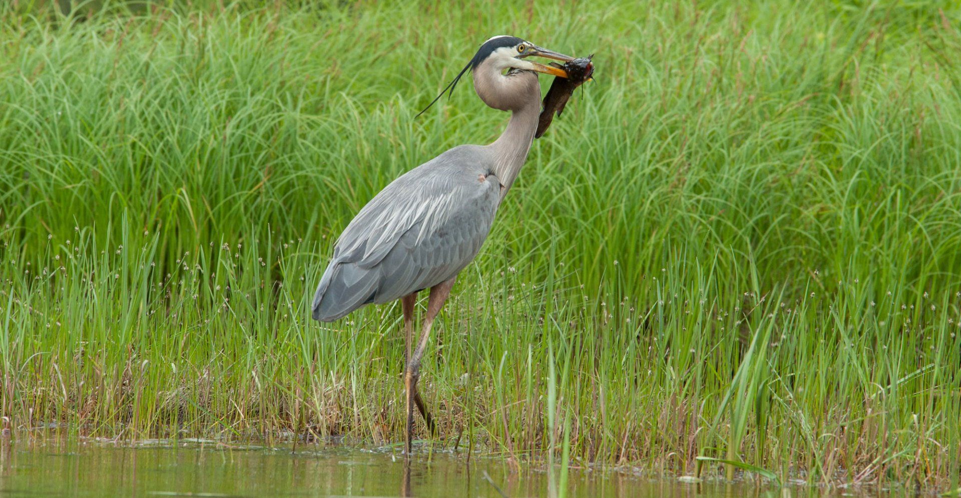
We are fortunate to have large areas of wetlands around Muskoka and Lake of Bays. Whether they are a marsh, bog, swamp or fen, each type of wetland plays a role in our water quality and wildlife food chain. The Lake of Bays Heritage Foundation (LBHF) wants people to understand how wetlands work, appreciate their importance and look for ways to ensure we keep them. Wetlands are called nature's kidneys because they act as a natural filtering system. Some types of wetlands can trap and neutralize sewage waste. This is done mainly by the wetland vegetation: plants absorb nutrients and help cycle them through the food chain. Plants also slow down flowing water and thereby cause silt to settle out. Wetland plants provide food to other wildlife species in addition to their normal role of providing oxygen through photosynthesis. By their ability to retain water, wetlands also provide a natural flood barrier that slows down the runoff of spring melt water and also storm water. This ability to hold back runoff makes them very useful in many parts of Canada because the normal low summer flow in rivers often causes serious problems for people and places depending on rivers for their water supply. The more wetlands there are in the drainage area, the higher the likelihood that serious water shortages can be prevented. Finally, wetlands also help to reverse global warming. Global warming is largely due to the release of carbon dioxide into the atmosphere. Wetlands are carbon sinks: the carbon from decaying plant and animal tissue accumulates in the wetlands rather than being released into the atmosphere as carbon dioxide. Wetlands are also well known for attracting birds. Wetlands are extremely important as a habitat for many species. All of Canada’s wetland areas provide breeding, nesting and wintering habitat for thousands of migratory birds and shorebirds. Birds that are commonly associated with wetlands include ducks, geese, swans, herons, bitterns and birds of prey such as ospreys. The Muskoka Watershed Council has developed a brochure to educate landowners on the value of small wetlands on their property. It deals with stewardship, species at risk, importance of wetlands and how to enjoy their wetland. It is available at www.muskokaheritage.org The Watershed Council has identified 68 significant areas and sites throughout Muskoka — around 30 of those sites are classified and protected as provincially significant wetland. You can access these websites for more information about caring for wetlands on your property: www.hww.ca or www.ducks.ca
Sign Up For Our Newsletter
Lake of Bays Heritage Foundation
P.O. Box 81, Baysville Ontario, P0B 1A0
info@lakeofbaysheritage.ca
Privacy Policy | Board of Directors Login
Site Designed & Developed by Client First Web Design & Graphics