Resources - Natural Heritage
Filter By:
All Resources | Natural Heritage | Community Heritage | Shoreline & Property Protection | Tax Relief | Tours & Guides | Watershed & Wetlands
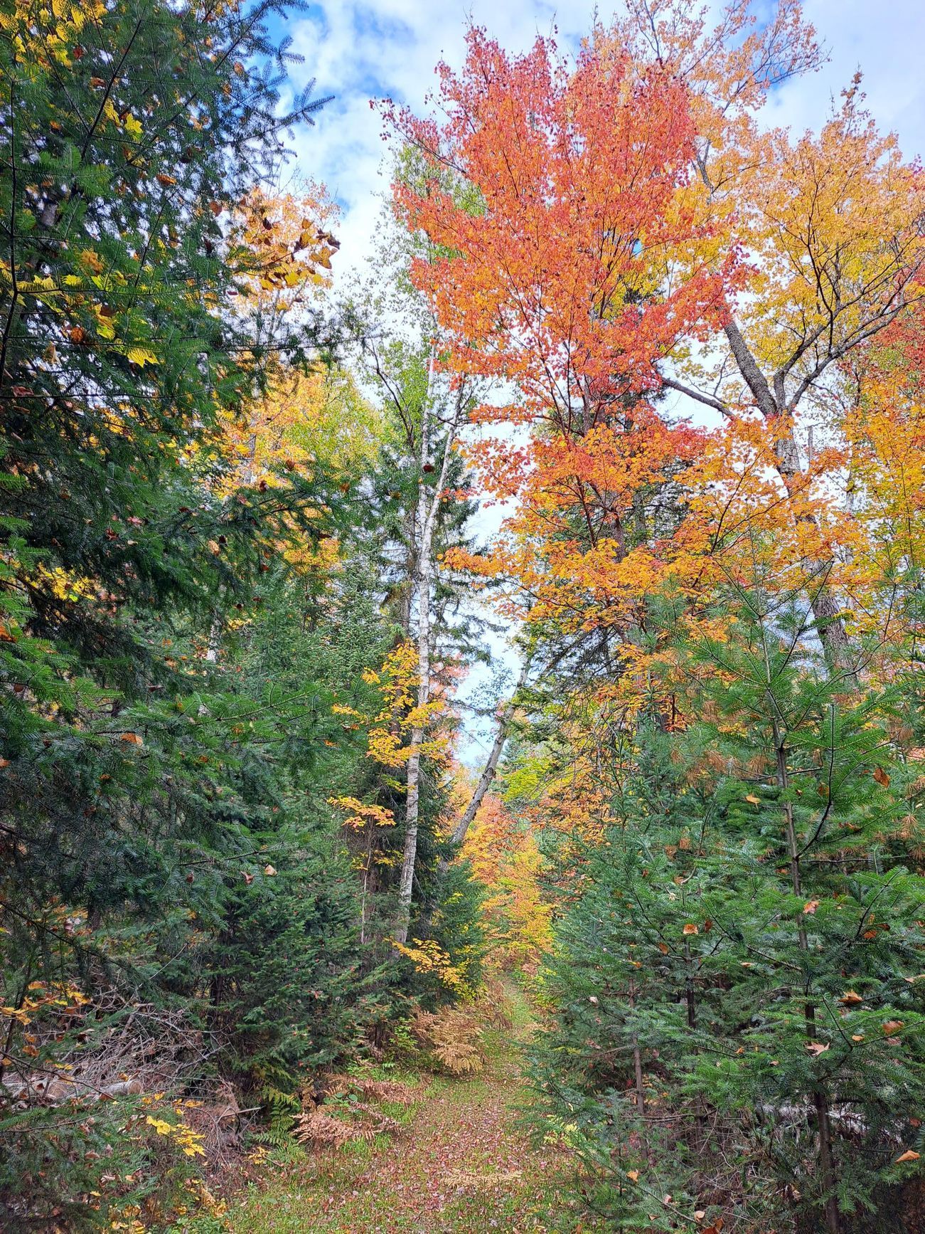
Why are native trees so important? It might be easy to think that there are enough native trees and shrubs in Ontario so planting a few non-native species on our properties should be fine. But recent research has shown that although birds may land on those non-native plants, they don’t get much benefit from them. Dr. Eric Davies from the Faculty of Forestry at the University of Toronto led a very important research project in Toronto where he selected four native tree species (Silver Maple, Red Oak, White Ash, American Elm) and compared the insect abundance and diversity to four non-native species (Norway Maple, Manitoba Maple, Scotch Elm, Tree of Heaven). His results were conclusive – native trees supported a wider variety and abundance of pollinators, moths, beetles, and other invertebrates. In fact, the non-native trees were almost devoid of insects. This really shouldn’t come as a surprise as it has been known for centuries that some non-native plants would be “pest free” as no insects would eat the leaves. This is exactly why so many urban landscapes use non-native plants. But we now know that to maintain and even enhance ecological integrity, we need to minimize forest fragmentation and protect wildlife corridors. And this is the role that Lake of Bays Heritage Foundation, as a land trust, can play with our protected properties. But we can also do our part on our own properties and restore ecological opportunities by switching to native species. And the results should be obvious – more birds in your backyards!
See the annual results for the Dr. Cathy Charles Bird Count held every spring at the Marsh's Falls Nature Reserve.
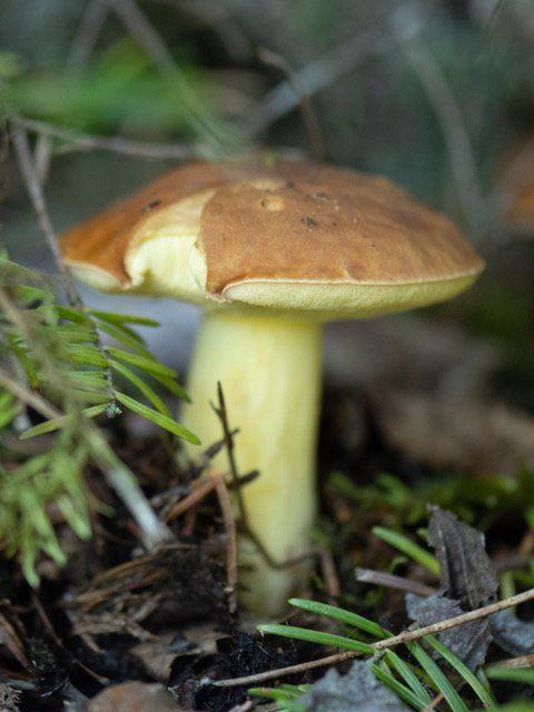
See the results for our mushroom forays held in late August and early September.
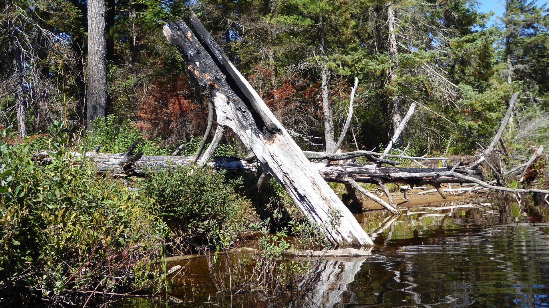
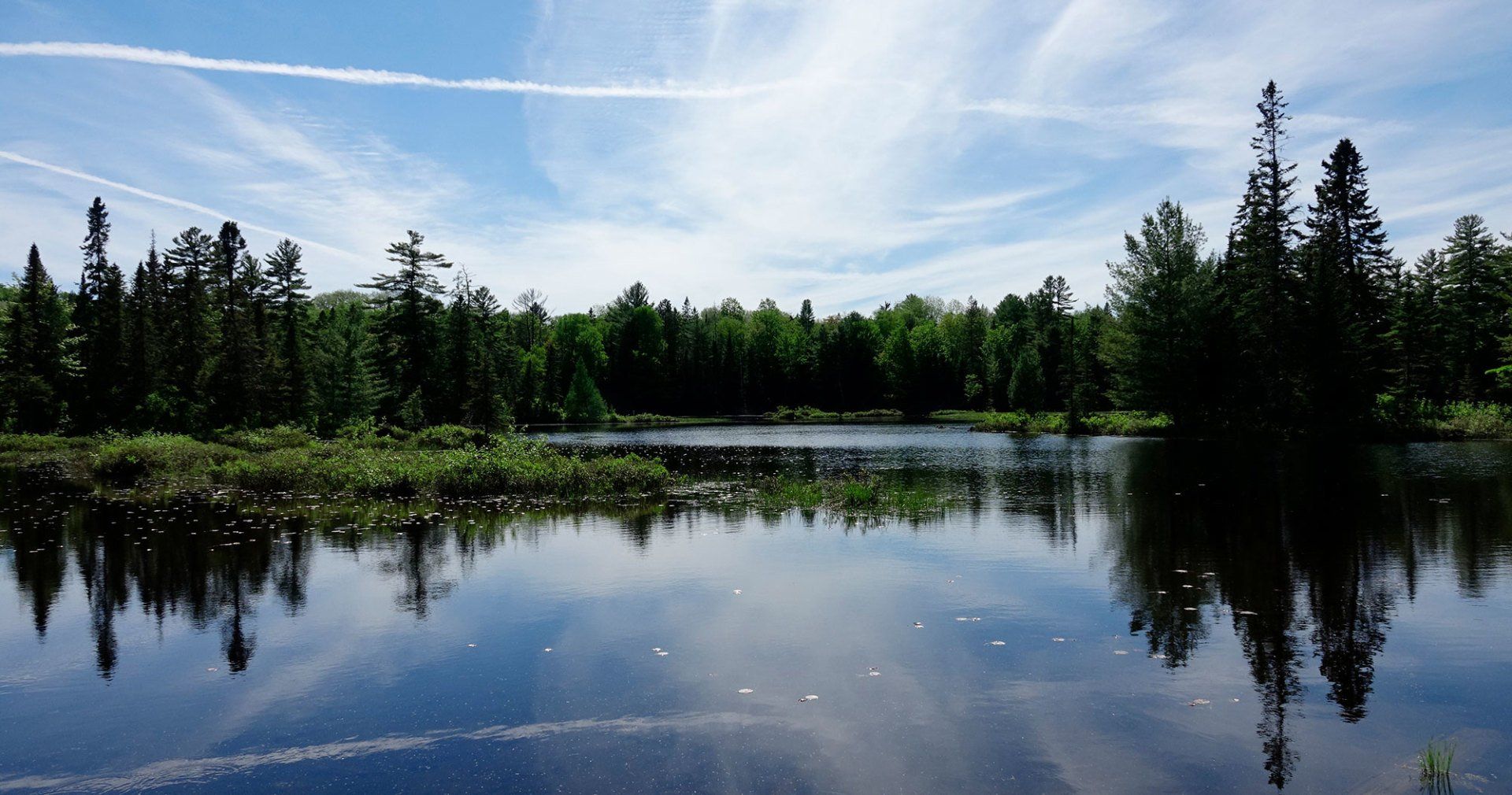
Three page impressionistic guide to the lower Oxtongue River. Stunning photos and informative text.
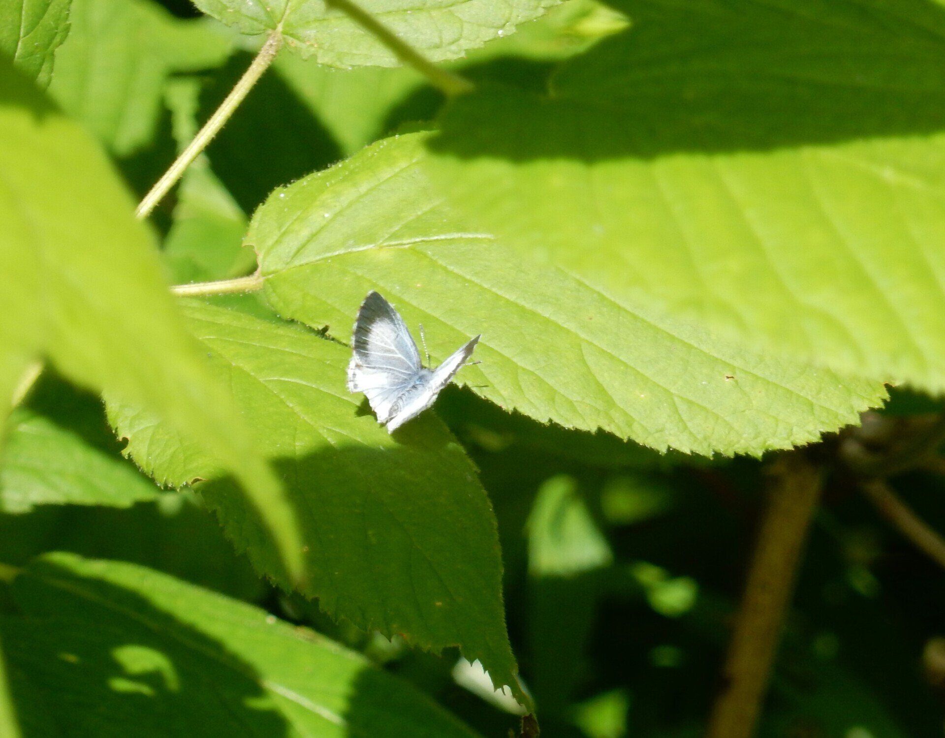
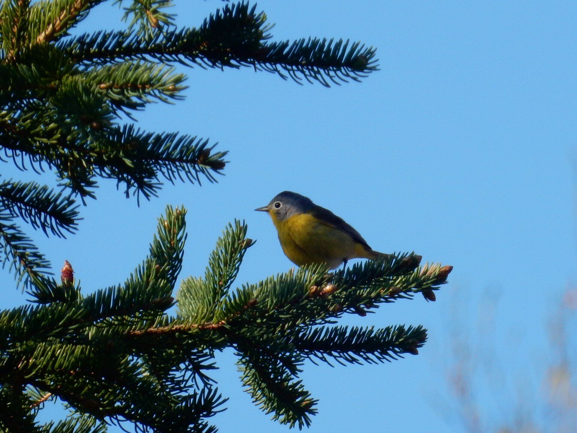
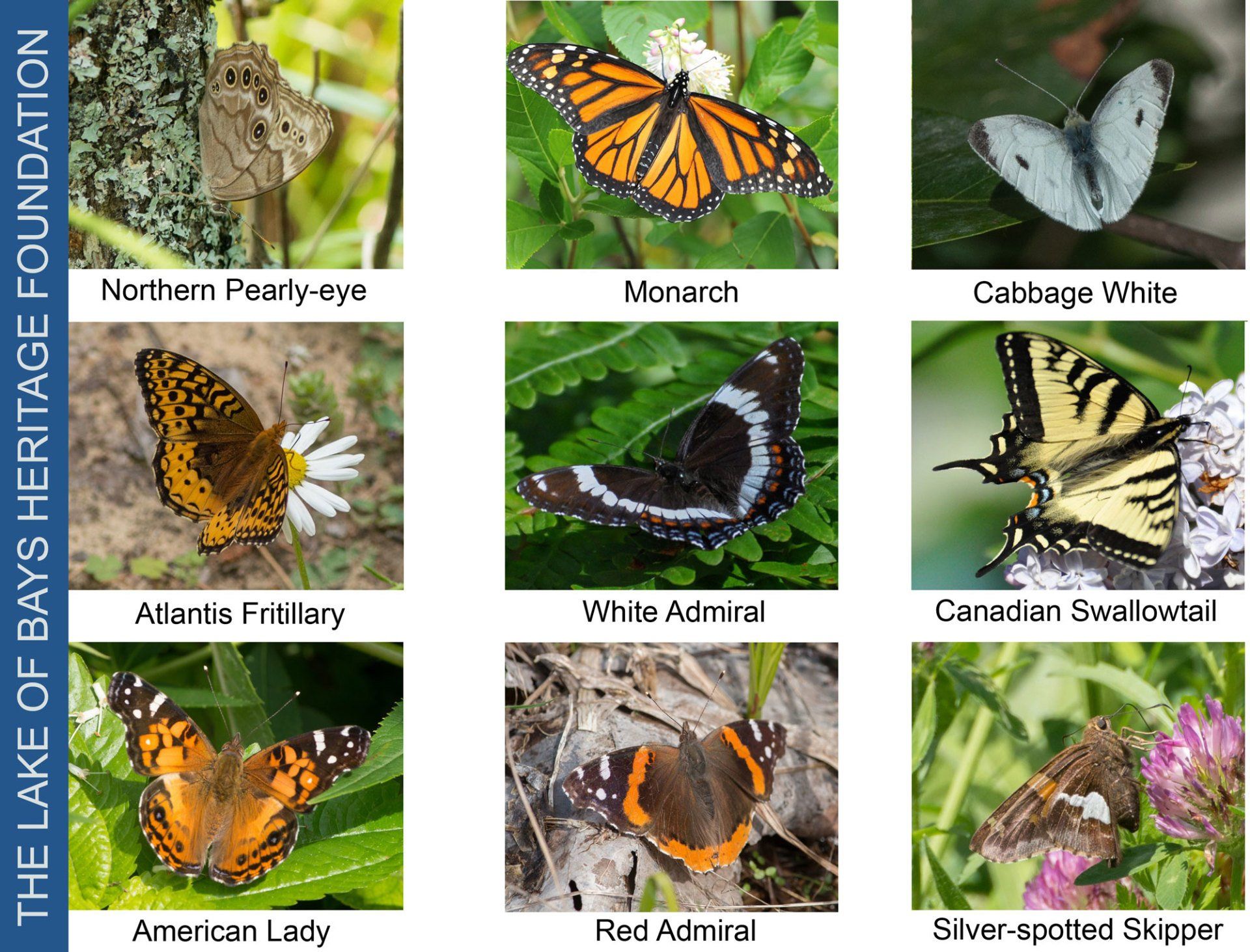
See the annual results of our butterfly count at held each July at the Marsh's Falls Nature Reserve.
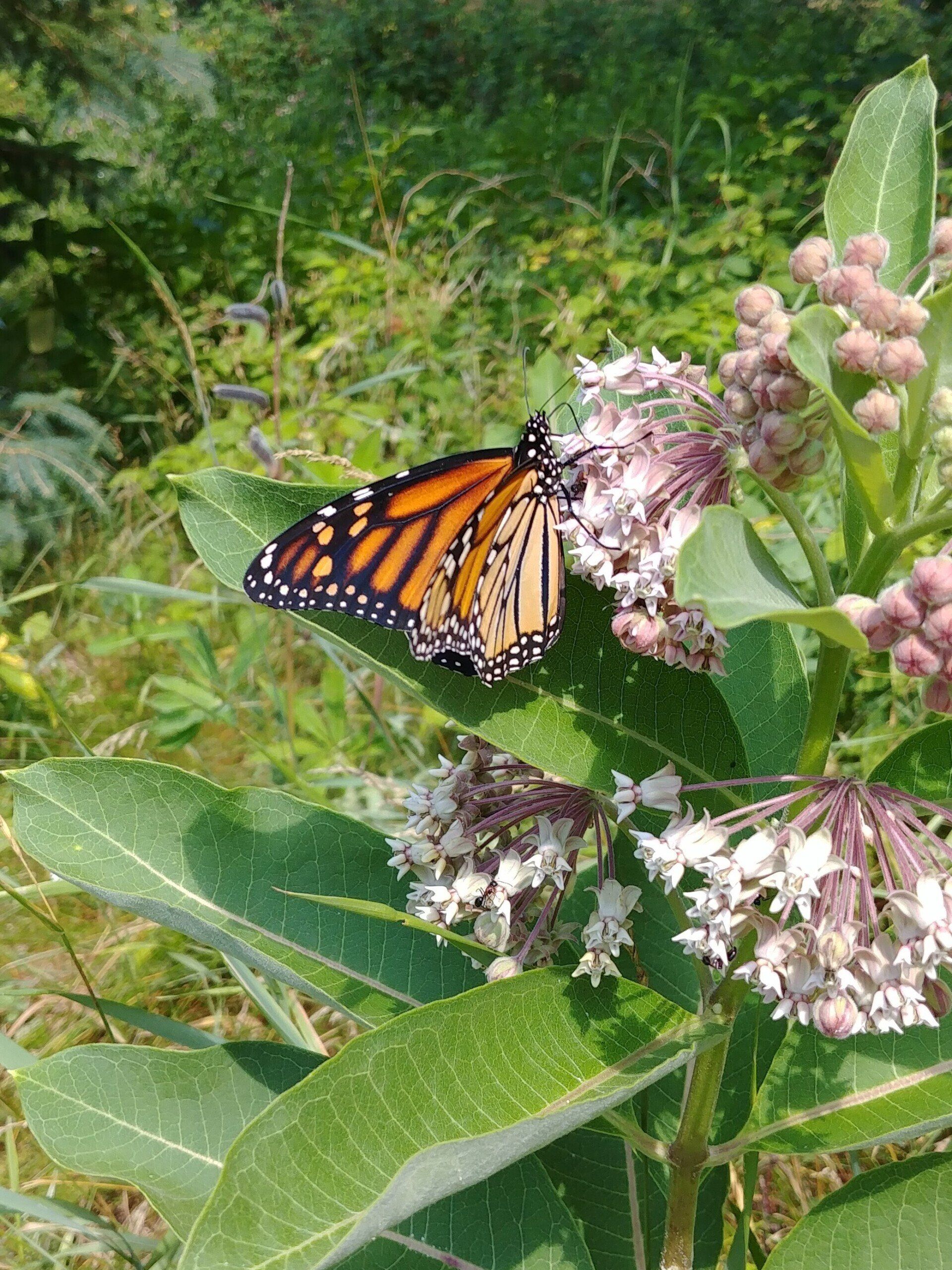
Learn about the Monarch's unique migration strategy, the many challenges this species faces, and what you can do around your home or cottage to help it survive.
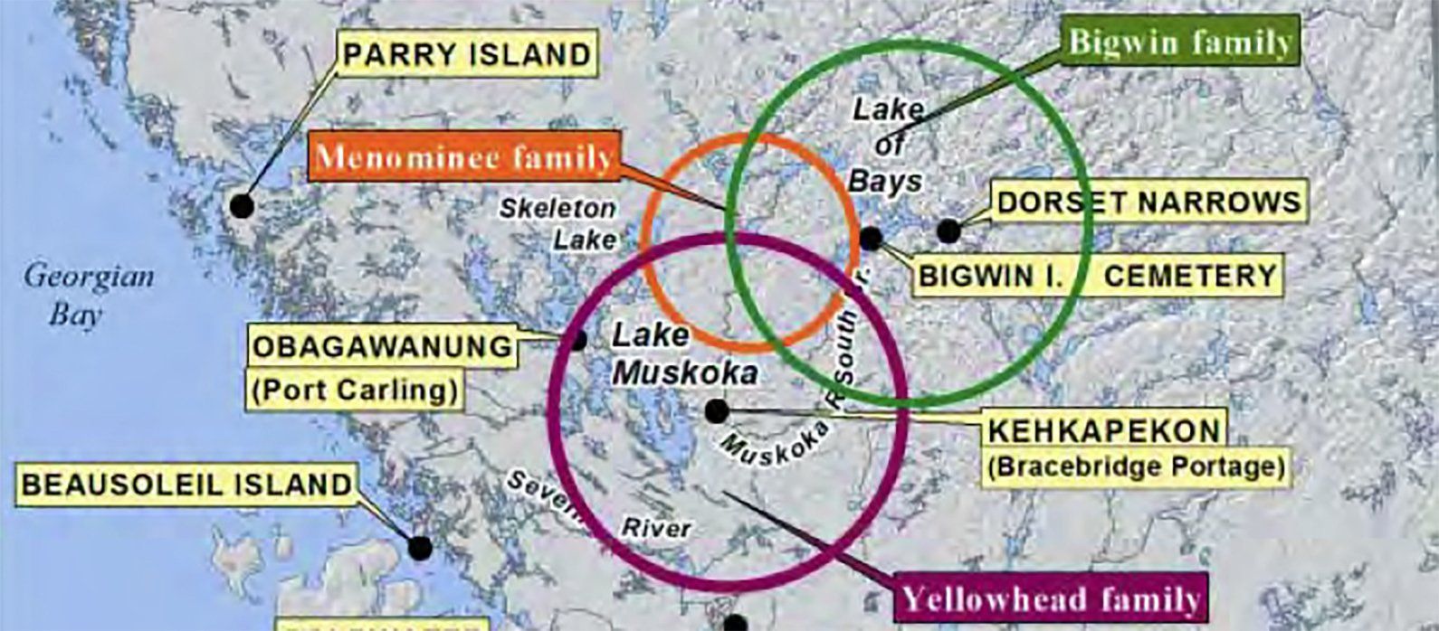
1. A Brief Illustrated History of Landscape and Aboriginal Peoples in the Muskoka Region. Click Here For the Full Presentation (PDF) 2. Report of the Master Plan of Archeological Resources of the District of Muskoka and The Wahta Mohawks. February 1994, 3 volumes. Volume 1 and Volume 2 3. Final Phase 1 Report of the Master Plan of Archaeological Resources of the District Municipality of Muskoka. Submitted to the District Municipality of Muskoka and the Mohawks of Gibson, 1992. View The Full Report
The Muskoka River watershed originates on the western slopes of Algonquin Park, descending 300 metres in elevation over a distance of 210 kilometres before flowing into Georgian Bay via the Musquash/Gibson and Moon rivers. The watershed is approximately 5,100 square kilometres (approximately the size of Prince Edward Island) and includes more than 2,000 lakes of various sizes with a total surface area of approximately 78,000 hectares. The watershed receives more than 1,000 millimetres of precipitation each year and is one of the wettest locations in the province of Ontario. Annual precipitation includes more than 300 centimeters of snowfall typically representing 20% to 25% of the annual wet precipitation amount. The lakes, rivers and wetlands within the Muskoka River watershed support a diversity of natural ecosystems, tourism and recreation activities, and businesses including hydroelectric generation. The Muskoka River is comprised of three subwatersheds: the north and south branches of the Muskoka River, and the Lower Muskoka subwatershed comprised of the Musquash/Gibson River and Moon River. There are a total of 41 water control structures located throughout the river including 11 waterpower facilities and 30 dams. The Ministry of Natural Resources (MNR) owns and operates 29 of these dams. There are 13 water control structures on the south branch of the Muskoka River and its tributaries including the Baysville Dam which regulates Lake of Bays water levels and downstream flows within the South Muskoka River. The portion of the south branch subwatershed upstream of the Baysville Dam is 1,481 square kilometres. Most of the inflow to Lake of Bays is from the Oxtongue River and Hollow River. Flows within the Oxtongue River are influenced or controlled primarily by the Tea Lake Dam within Algonquin Park which regulates water levels on Tea Lake and Smoke Lake. Flows within the Hollow River are controlled by the Kawagama Lake Dam which regulates Kawagama Lake water levels. In 2002, the MNR produced the Water Management Planning Guidelines for Waterpower to provide a formal planning framework for the operation of waterpower facilities and dams for river systems within the province. A water management plan is intended to provide for the management of water levels and flows on a “watershed” basis to equitably address or balance environmental, social and economic interests within the lakes and river reaches. The Muskoka River Water Management Plan (MRWMP) came into affect in June, 2006. This plan provides for the management of water levels and flows as they are affected or controlled by the operation of each water control structure. Currently there are four waterpower companies and the MNR Parry Sound District signatory to the MRWMP. The MRWMP report and additional information and resources can be viewed on the Muskoka WaterWeb at: www.muskokawaterweb.ca/water-101/water-quantity/mrwmp . The MRWMP includes the lake Operation Plan for each water control structure, enforceable provisions for the management of flows and levels, compliance monitoring to ensure that waterpower facilities are meeting requirements, and effectiveness monitoring to determine whether the ongoing implementation of the plan results in attaining the ecological, social and economic objectives. A number of objectives were identified during the planning and consultation phase of the MRWMP which includes the following: Social and Economic Objectives maintain public safety during high flow periods or flood events avoid adverse impacts to built infrastructure and shorelines maintain or enhance recreational capacity of lakes enhance base flow conditions in river reaches especially during periods of drought maintain or increase hydropower potential remain within current operational and flow passage capabilities of water control structures remain within the established normal operating zones for developed lakes Ecological Objectives higher and/or longer duration spring peak levels for fish and wildlife reproduction and habitat gradual water level reduction on lakes throughout the summer period; improved base flow conditions and water quality in river reaches downstream of water control structures provide for moderate seasonal and inter-annual variability in levels and flows; consideration of more natural flow regimes less differential between fall and winter drawdown levels to prevent or reduce lake trout egg mortality and promote successful lake trout reproduction Water levels, flows and the overall “health” of the Muskoka River system are monitored and evaluated on an ongoing basis by a number of government agencies, organizations and groups. Environment Canada in partnership with the MNR maintains automatic (electronic) gauges throughout the river system. Daily water levels are recorded by these gauges for most of the regulated lakes with daily flows recorded for the north and south branches and lower subwatershed. Lake levels are manually recorded at least once per week where an automatic gauge is not available. On a daily basis, MNR Parry Sound District water control technicians collect, compile and analyse level and flow data along with other environmental information such as rainfall and snowpack conditions; including snowpack water content. The data and information is used to determine which MNR dams need to be operated to meet flow and level objectives. Lake levels and downstream flows are altered by either placing or removing a certain number of control stop logs from a dam to best meet seasonal objectives of the MRWMP and water level regime identified in the Operating Plan for each lake. Close communication with the various waterpower producers is maintained to ensure a coordinated approach to water management throughout the river system. Ongoing documentation of water levels and flows provides the opportunity to monitor conditions over time. Changing weather patterns or climate can alter the hydrology of a watershed over a relatively short timeframe or extended period of time. For example, climate change may create greater fluctuations in flows and levels and possibly increase the frequency and severity of both flood and drought events. The MRWMP and other similar plans within the province provide for an “adaptive management” approach to water management planning. As new information and science becomes available, the MRWMP can be amended as required to prescribe new or altered level and flow requirements and objectives. Thanks to Steve Taylor, Water Resources Coordinator, MNRF Parry Sound District who provided this article in September 2012.
Certain forests in Ontario may be privately owned, but they benefit all Ontarians. The Ontario Managed Forest Tax Incentive Program (MFTIP) recognizes the importance of these lands. The goal of the MFTIP is to bring greater fairness to the property tax system by valuing forests according to their current use. The program is designed to increase landowner awareness about forest stewardship. L andowners with more than 4 hectares of forest who apply and qualify for the program have the eligible portion of their property classified and assessed as Managed Forest under the Managed forests property class. The eligible land is taxed at 25 percent of the municipal tax rate set for residential properties. For the details on how your property my qualify for this very important program, please visit https://www.ontario.ca/page/managed-forest-tax-incentive-program .
Sign Up For Our Newsletter
Lake of Bays Heritage Foundation
P.O. Box 81, Baysville Ontario, P0B 1A0
info@lakeofbaysheritage.ca
Privacy Policy | Board of Directors Login
Site Designed & Developed by Client First Web Design & Graphics